
Ask a site supervisor how deep a buried cable runs and many will point to the Before You Dig Australia (BYDA) plan as if it settles the question. It does not. The honest answer to “how often does the plan get the depth wrong” is more surprising than most people expect, because in most cases the plan never gives you a depth at all.
That is not a criticism of BYDA. It is what BYDA says about its own service. Understanding the gap between what a plan shows and what is actually in the ground is one of the most useful things a contractor can learn, and it explains why so many strikes happen on sites that did everything by the book.
What a BYDA plan actually tells you
A BYDA request returns plans supplied by asset owners such as Sydney Water, Ausgrid, and the major telcos. Those plans are useful. They tell you that services are likely present on your site and give a general sense of where they run.
BYDA describes these plans as indicative only. In its own guidance, the service tells users to treat plans as a guide, never to assume pipes and cables run in a straight line, and never to assume a set depth. BYDA also advises engaging an accredited locator when you need to know where assets really are.
So the plan answers the question “is something likely here.” It does not answer “exactly where is it, and how deep.”
Why depth is usually missing, straight from the source
This is the part that catches people out. BYDA’s own FAQ explains that asset owners, in most cases, do not supply depth or alignment measurements at all.
The reason is sound. Many assets were installed decades ago. Since then the surface above them can rise or fall. Floods, landscaping, road works, and changes to ground levels all shift how deep a service sits relative to today’s surface. A depth recorded thirty years ago could be meaningless now, and a false depth is more dangerous than no depth, because it breeds false confidence.
Asset owners also have no ongoing view of what happens around their pipes and cables after install. They cannot see the patio someone built, the fill that was added, or the cable a neighbouring trade rerouted. So rather than hand over a number that might be wrong, they leave depth out.
Read that back and the picture changes. The depth on your plan is not slightly off. It is usually not there, and where a figure does appear, it should be treated as a starting point, not a guarantee.
The position problem on top of the depth problem
Depth is only half of it. Horizontal position carries the same warning label.
Plans show the recorded route of a service, but the real line can sit to one side, curve where the plan shows it straight, or stop and restart where a repair was made over the years. Locators who verify services on site regularly find that the actual position varies from the plan, sometimes by a little and sometimes by a lot.
Then there are the services that do not appear at all. Not every asset owner in Australia is a BYDA member, and private services on a property, such as a line running from a meter to a shed, are rarely recorded anywhere. Older parts of Sydney are full of these undocumented assets. A plan that looks clean can still be hiding a live cable that nobody mapped.
Why this matters more on Sydney sites
Sydney’s underground is a mix of old and new. Inner suburbs carry legacy water, gas, and electrical assets that predate clean record keeping. Newer growth areas have services going in fast, often with several trades working the same corridor.
Both situations create risk. In old areas, the records are thin and the ground has changed. In new areas, the records cannot keep up with the pace of work. Either way, the BYDA plan is a reasonable first step and a poor final answer. The same legacy infrastructure that makes utility work across Sydney tricky is the reason a plan alone leaves you exposed.
Plans plus verification: how the gap gets closed
The fix is not to ignore BYDA. It is to treat the plan as the input, not the output.
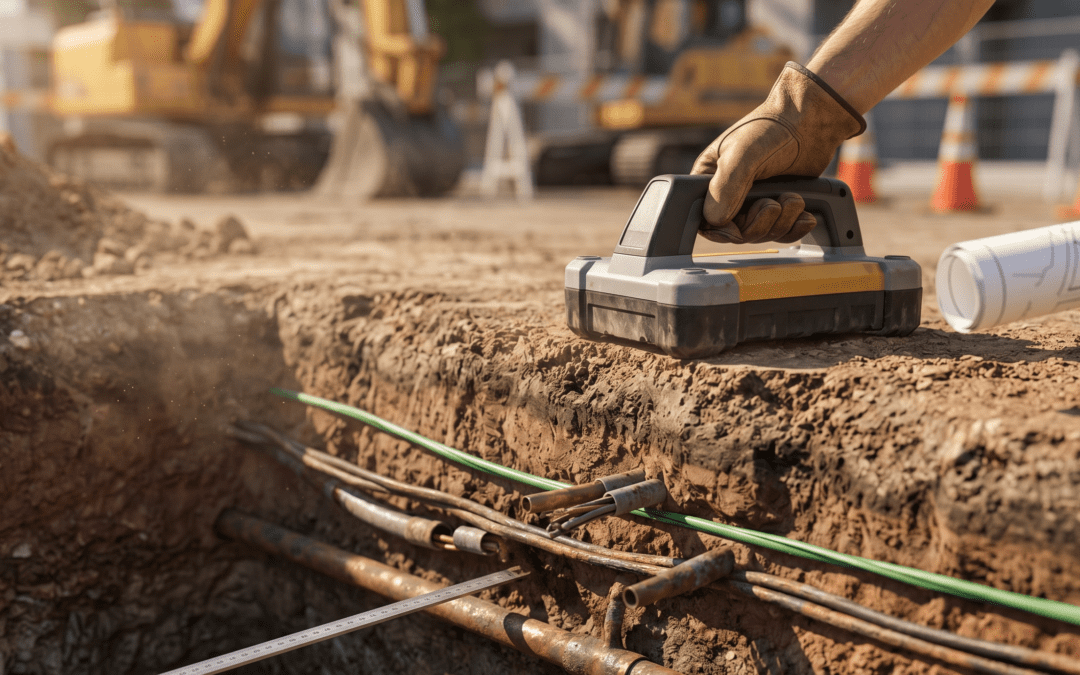
A physical locate takes the plan and tests it against reality. Utility location services use electromagnetic induction to trace metallic and conductive services, and ground penetrating radar to pick up assets that do not respond to metal detection, including plastic pipes and unrecorded lines. The result is the route marked on the ground, the position confirmed, and the depth measured at the site as it is today.
That is the difference between a plan and a survey. A plan says a service is probably in this area. A survey says here is the line, here is how deep it sits, and here is where you can dig safely.
What this means for your next dig
If your damage prevention process stops at lodging a BYDA request and printing the plans, you are working off information that BYDA itself tells you to verify. That is a real liability, and it is one that shows up the moment a bucket finds a cable that the plan said was a metre away.
A few practical habits help:
- Treat every BYDA plan as indicative, because that is what it is.
- Never assume a depth that the plan does not actually state.
- Assume undocumented services may exist, especially on older or modified sites.
- Bring in an accredited locator to verify position and depth before excavation, exactly as BYDA recommends.
Doing this does not slow your project down. It removes the surprise that would have stopped it cold. The spend on verification is small next to the standing time, repairs, and delays a single hit creates.
The plan tells you something is probably there. Verified locating tells you exactly where it is. On any dig that matters, you want the second one. If you have works coming up and want the ground checked properly, talk to the team at Locate & Map about a survey before you break ground.